Precision Mapping With Drones
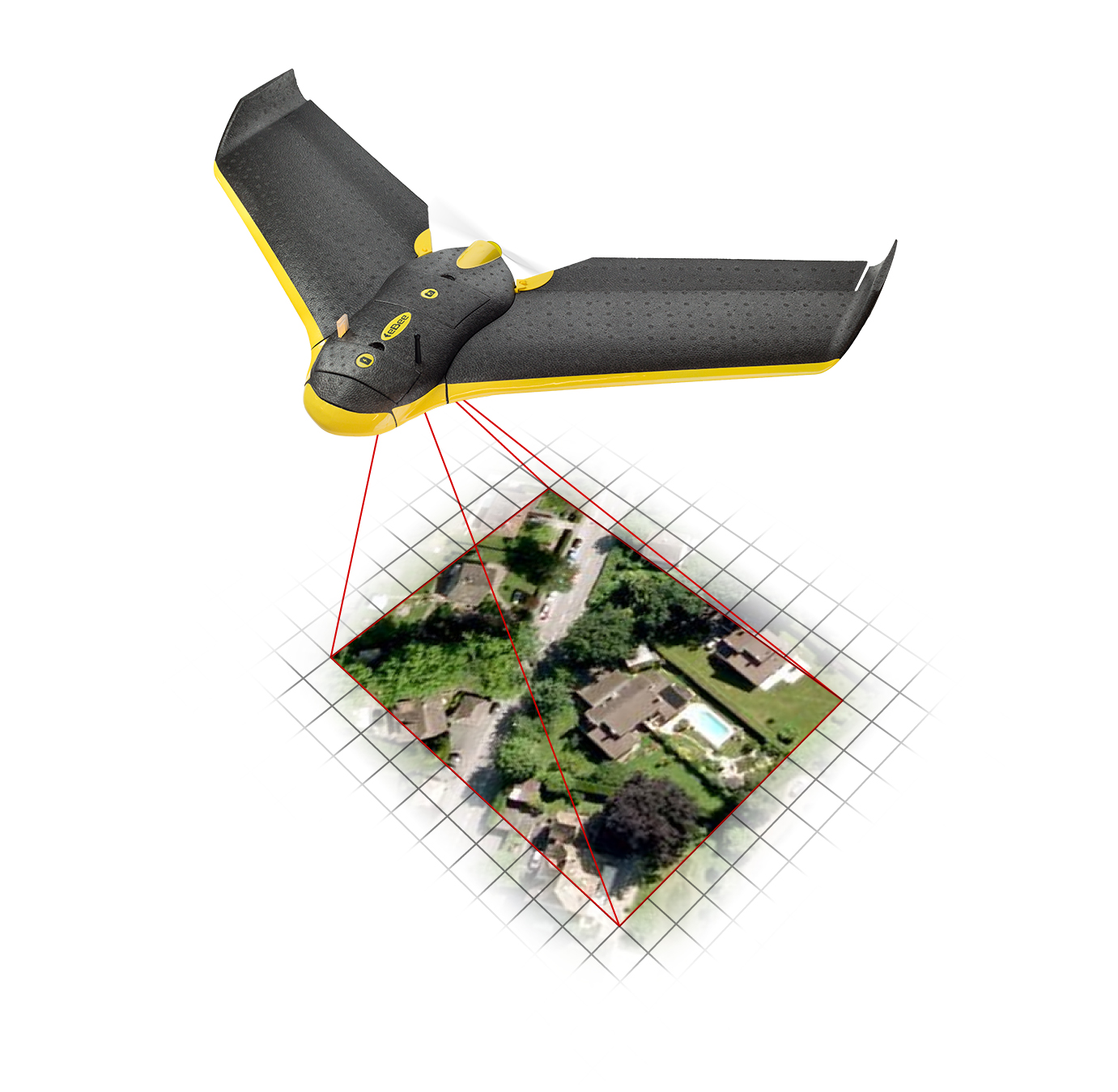
The increasing use of UAVs (Unmanned Aerial Vehicles) for aerial photography and lidar mapping has opened up many new opportunities for industries around the world that need to create accurate surveys. With GPS-equipped drones that house powerful digital cameras and computers, UAV mapping can now be done with great precision and accuracy.
Although aerial photography and lidar mapping are still in the early stages, they present a world of new opportunities. In the next decade, there will be excellent job opportunities for people interested in learning the industry. New high-tech drones present so many terrific uses for industries like archaeology, agriculture, mining, as well as for world organizations that provide life-saving humanitarian aid. We are seeing the tip of the iceberg right now with drone use, but there is certainly much more to come in this growing industry. The use of GPS-enabled UAVs for aerial surveying is very cost effective in comparison to using helicopters or light aircraft with aerial photography equipment. Because UAVs are relatively inexpensive to purchase and operate, many worldwide industries and organizations can have their own fleet of drones which will allow for rapid surveys over very large land areas.
How Does Lidar Mapping Work?
UAV lidar (Light Detection And Ranging) involves mounting a laser scanner on a UAV to measure the height of different points in the landscape. These UAV lidar scanners can capture hundreds of square kilometers of land mass in a single day. Images are then measured, using 10 to 80 points per square meter, to create an extremely detailed digital model of a landscape. Lidar sensors can also pierce through dense overhead canopy and thick brush or vegetation on the ground, making it possible to capture the bare earth below. Other satellites used in the past could not detect anything below the ground cover, so important changes in the earth’s surface could not be monitored, studied or accurately surveyed.
With the use of sophisticated high-tech drones, precision mapping used for research and studies are more accurate than ever before. Industries will benefit from increased efficiency and reduced costs to produce surveys that can change the way we do things. Here are just some of the industries that use UAVs for vital information:
- Archaeology
- Agriculture
- Mining
- Forestry Management and Planning
- Coastline Management and Exploration
- Oil and Gas Exploration
- Urban Planning
- Transport Planning
- Cellular Network Planning
- Flood Modeling
- Pollution Modeling
- Mapping and Cartography